Eleven Nigerian Site Watch sites. All anchored on public sources.
Each Site Watch entry in Lilliewatch Onshore is anchored on at least one publicly-documented incident with a specific named location, a specific date, and a quantified operational outcome. Three of the eleven are described in detail below as the foundational case studies. The full inventory of eleven sites spans five South-South states (Lagos, Bayelsa, Rivers, Cross River, Akwa Ibom) with sources from Vanguard, The Guardian Nigeria, Daily Trust, ThisDay, the Nigerian Tribune, Channels TV, SweetCrudeReports, the Bayelsa State Oil and Environmental Commission, the Nigerian Navy, the Nigerian Upstream Petroleum Regulatory Commission, and the Lagos State Government. The complete provenance log is the file docs/evidence/site_watch_sources.md in the public repository.
SARConfirmed
ThermalConfirmed
NDVIConfirmed
SO₂Confirmed
Oil spillage · retrospective
Aiteo OML-29 Wellhead Blowout
November 1 to December 7, 2021 · Nembe LGA, Bayelsa State
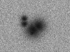
Sentinel-1 SAR
2 oil-sheen detections downstream of wellhead · creek-network drift
Public record
An Aiteo-operated wellhead at OML-29 experienced a blowout that released crude oil continuously for 38 days into the Nembe creek network. The Bayelsa State Oil and Environmental Commission (BOSEC) documented the spill in its 2023 report.
Our detection
2 SAR oil-sheen signatures at 4.44°N / 6.35°E and 4.43°N / 6.60°E during the 60-day window. Both downstream of the wellhead, consistent with creek-network drift toward the Atlantic. VV polarization values of -22.9 and -23.3 dB confirm strong oil-on-water radar dampening.
SAR is the right sensor for oil on water. The release was satellite-visible across multiple cloud-free passes during the incident window.
Detected 2024-H1 · Confirmed by Navy raid, March 2026 · Rivers State
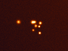
VIIRS thermal + XGBoost
C12 HIGH-risk cluster · same LGA as the Navy's 2026 refinery raid
Public record
In March 2026, the Nigerian Navy's Forward Operating Base Bonny (Operation Delta Sentinel) destroyed an active illegal refinery at Allison Community, Bonny LGA. The site contained dugout pits and locally-fabricated cooking and cooling systems. 20,000 litres of stolen crude oil recovered.
Our detection
Cluster C12 at 4.42°N / 7.16°E, classified HIGH-risk refinery candidate by our XGBoost model. Mean fire count of 21.5, the highest persistence signal of any cluster in the corridor. Detected from 2024-H1 thermal data, 24 months before the Navy operation.
The methodology identified the activity zone two years before public enforcement action.
Post-raid · Site Watch
After the March raid we kept monitoring. Site Watch tracks six weeks of weekly imagery across SAR, thermal, SO₂ and NDVI for the C12 centroid. Pre-raid, all four sensors agree on active combustion. Raid week shows a coordinated collapse on thermal, SAR and SO₂. The week after, those three sensors stay below 25% of their pre-raid means; NDVI scarring is still visible but the site reads as quiet.
This is the operational follow-up: a re-emergence watch that catches bunkers being rebuilt within two to six weeks of a strike, before they are back at full production. View Site Watch on the dashboard →
Feb 2024: Nigerian Army discovers 40 illegal oil wells at Rumuekpe (Emohua LGA). Throughout 2024: Shell reports oil spills along Assa-Rumuekpe, Rumuekpe-Nkpoku, and Kolocreek-Rumuekpe pipelines. Aug 2024: Shell-Navy joint operation destroys 72 illegal refineries in 5 days.
Our detection
13 candidate combustion sites detected along the TNP corridor in 2024-H1 data. 3 classified HIGH-risk refinery candidates (C4, C6, C12). 1 MEDIUM flare candidate (C0). 69 persistent thermal hotspots grouped via DBSCAN spatial clustering.
Corridor-level detection aligns with the publicly-documented active-incident zone across Army, Navy, and Shell sources.
Each detection above came directly from the production Lilliewatch pipeline running against the dates and bounding boxes listed. Module 1 ingests Sentinel-1 SAR, VIIRS/FIRMS thermal, TROPOMI SO₂, and Sentinel-2 NDVI imagery via Google Earth Engine. Module 2 applies feature engineering and DBSCAN spatial clustering. Module 3 runs the XGBoost risk classifier trained on Niger Delta weak labels.
Public records were sourced independently through search queries against major Nigerian newsrooms (Vanguard, Punch, THISDAY, Daily Post) and government documentation (Bayelsa State Oil and Environmental Commission, Nigerian Navy press releases). Cross-referencing happened after the detections. We did not run the pipeline against pre-selected incident coordinates.
Two methodological caveats are worth stating directly. First, the Bonny case is an LGA-level geographic match, not an exact coordinate match. The Navy's March 2026 raid was reported as occurring in "Allison Community, Bonny LGA" without published GPS coordinates. Our C12 cluster sits in the same LGA with a HIGH-confidence classification. The match is consistent but not absolute. Second, our case-study AOIs are deliberately small (~30 km × 30 km for Aiteo; ~100 km for TNP). Production deployments would expand bounding boxes to capture full pipeline corridors and downstream creek networks, increasing detection volumes substantially.
See the live system that produced these detections.
The same methodology runs continuously across eleven Nigerian AOIs. The dashboard reflects whatever the GitHub Actions cron has produced in its most recent six-hour cycle.